"" Dangerous Flash Flooding, Along With Severe
Thunderstorms, Tornadoes in the South
(FORECAST)
The threat of torrential rain is kicking into high gear, and
will persist in parts of the South for the next several
days, where over a foot of rain may trigger dangerous,
life-threatening flash flooding.
Among the cities that should be alert for potentially major
flash flooding the next few days are Dallas-Fort Worth,
Houston, San Antonio, Austin, Shreveport, Louisiana and
Little Rock, Arkansas, and New Orleans.
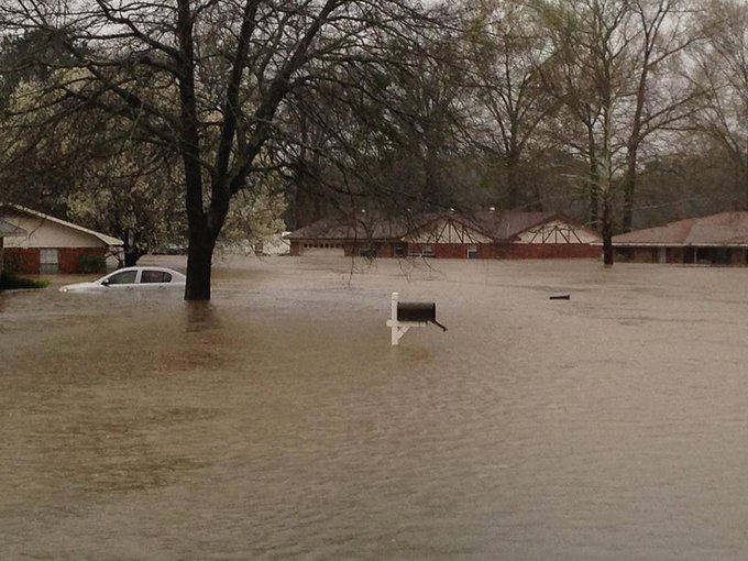
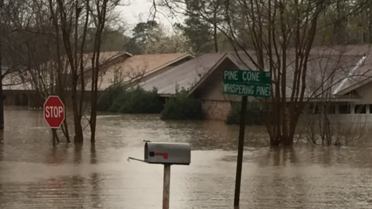
The flooding already kicked in Monday night, flash
flooding west of Ft. Worth, Texas, swamped homes and
forced water rescues
If that wasn't enough, severe thunderstorms and at least
some tornadoes, are expected through at least
Wednesday in some of the same parts of the southern
Plains, Lower Mississippi Valley and Gulf Coast.
NOAA's National Weather Service has issued a tornado
watch for portions of East Texas, far southeastern
Oklahoma, southwestern Arkansas and western Louisiana
until 6 p.m. CST. The watch includes the cities of
Houston, Shreveport and Texarkana.
An EF1 tornado caused damage near Cool, Texas
Monday evening and an apparent tornado touched down
near Tolar, Texas, southwest of Ft. Worth Tuesday
morning. An EF1 tornado also left a narrow path of
damage in Stephenville, Texas early Tuesday. A squall line
then surged through Ft. Worth packing a 66 mph gust at
the Ft. Worth Meacham Airport and a gust to 72 mph at
Interstate 820 and Blue Mound Road.
Below is a breakdown of the flooding and severe weather
threats the next several days followed by an explanation
of what is causing the stormy weather.
Flooding Threat
The National Weather Service has issued flash
flood watches parts of East Texas, southeast
Oklahoma, most of Arkansas, western Lousiana,
southern Missouri and southwestern Illinois.
A "cutoff" low sits and spins over Mexico and
Texas, keeping a stream of moisture pointed at the
south-central states.
Periods of rain and thunderstorms will take aim on
parts of the southern Plains eastward to the
Mississippi River Valley, northern Gulf Coast, Ohio
Valley and Tennessee Valley.
Persistent, slow-moving bands of rain and
thunderstorms may ultimately drop a foot of rain
or more in some of these areas, triggering
dangerous, life-threatening, destructive flash
flooding and river flooding.
The area at highest risk includes parts of east and
north Texas, southeast Oklahoma, Arkansas,
western and northern Louisiana and southern
Missouri.
Potential cities: Dallas | Houston | Shreveport |
Little Rock
The flood threat may persist in parts of the Lower
Mississippi Valley and Deep South into Friday.""
https://weather.com/storms/tornado/news/severe-flood-forecast-march-7-12-2016


Upload photo
Would you look at a profile that doesn't have photos?
Probably not! Upload a photo for others to be interested.
- Higher position in search results!
- Users with pictures get 10 times more responses in their messages
- Most people only contact those with pictures
Jenny
Lina
Anna
Jessica
Dony